 En el departamento de Córdoba, de sur a norte, la cordillera Occidental se trifurca en las serranías de Abibe, Ayapel y San Jerónimo, formando una región montañosa, entre ondulada y quebrada. Hacia el sur se encuentra el Parque Nacional Natural de Paramillo, una importante reserva ecológica de Colombia donde nacen los ríos Sinú y San Jorge.
Con dirección a la zona costera, la serranía de Abibe, que separa la llanura aluvial costera de la cuenca del Atrato, se bifurca en las sierras de El Águila y Las Palomas, para morir esta última cerca al mar en Punta Arboletes, en límites con Antioquia. El punto más elevado de la serranía de Abibe es el Alto de Carrizal (2.200 metros sobre el nivel del mar). Otras elevaciones importantes son el Alto de Carepa (1.600 m.s.n.m). y Alto de Quimarí (1.600 m.s.n.m.). La serranía de Ayapel separa el río San Jorge del río Cauca y muere en territorio antioqueño. Estas dos serranías, la de Abibe al occidente y la Ayapel al oriente, sirven de límites naturales con el departamento de Antioquia.
 Por su parte, la serranía de San Jerónimo, la más larga, cruza por el centro del departamento y divide la gran llanura de Córdoba en los dos grandes valles del Sinú y del San Jorge, que ocupan 18.765 Kms2, casi el 80% de su extensión. Esta serranía atraviesa el departamento de Sucre y va a morir en Bolívar, en los conocidos Montes de María.
La región sur del Departamento es montañosa con relieves pertenecientes a las Serranías de Abibe, San Jerónimo y Ayapel, que son prolongaciones de la Cordillera Occidental. Allí se encuentra el Parque Natural de Paramillo, reserva natural que posee bosques secos de llanura, selvas húmedas en las tierras bajas y de montaña y cimas como la del Paramillo del Sinú, en la culminación de la Cordillera Occidental. Alberga una de las mayores concentraciones de fauna y flora nativa del norte de Suramérica y allí nacen los ríos Sinú y San Jorge. Tiene una extensión de 460.000 hectáreas y alturas desde 100 hasta 3.960 metros.
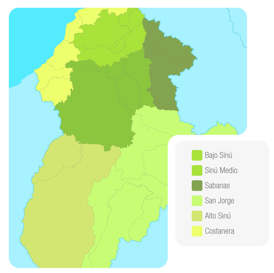
Subregiones Ambientales Córdoba
Localización Física
Además de las serranías mencionadas, el departamento de Córdoba presenta algunos accidentes orográficos destacados como el cerro Murrucucú y la cuchilla de San Antonio.
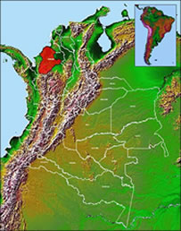
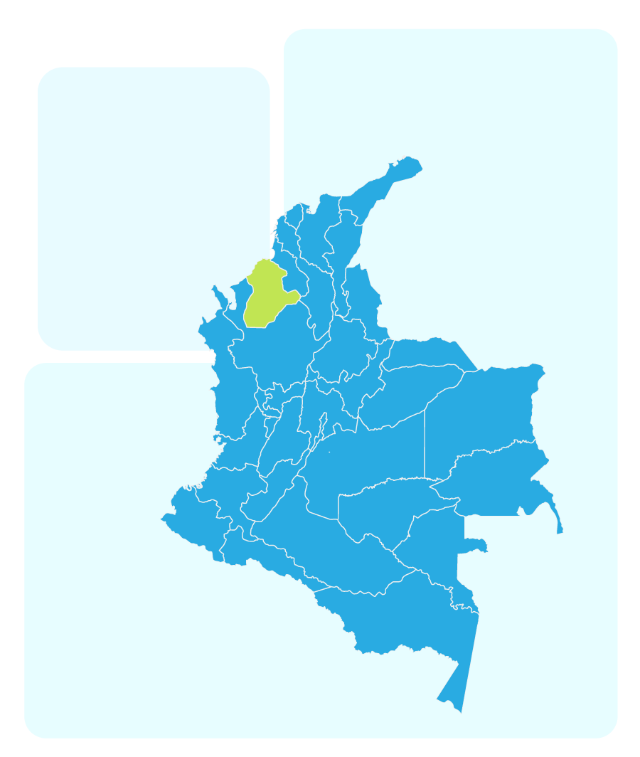
El departamento de Córdoba se encuentra localizado en la región del Caribe colombiano, en el extremo nor occidental del país; localizado entre los 09°26’16” y 07°22’05” de latitud norte, y los 74°47’43” y 76°30’01” de longitud oeste y cuenta con una superficie de 25.020 km2. Figura 1.
El territorio departamental está conformado por las cuencas de los ríos Sinú y San Jorge. La orografía cordobesa presenta dos grandes áreas, una plana y otra de montañas y colinas; a la primera pertenecen los valles del sinú y del San Jorge, donde están situados la mayor parte de los municipios que tienen el más alto desarrollo económico departamental. (IGAC, 1996).
El área total del departamento es de 2’506.822 hectáreas en la cual se encuentran las cuencas: Río Sinú que representa el 52% del área departamental y Río San Jorge el 38%, que ocupan, el 90% del territorio cordobés, el 10% restante corresponde a la denominada zona costanera de Córdoba, que involucra cuencas de menor extensión, las cuales drenan directamente al mar en la costa cordobesa, el 3,8% del área, en la costa del departamento de Sucre.
Localización Administrativa
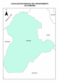
El departamento de Córdoba se localiza en el norte del país y limita por el norte con el mar Caribe y el departamento de Sucre, por el este con los departamentos de Sucre, Bolívar y Antioquia, por el sur con el departamento de Antioquia y por el oeste con el departamento de Antioquia y el mar Caribe.
Localización Administrativa del departamento de Córdoba
Córdoba se encuentra dividido en 30 municipios: Montería, ciudad capital, Ayapel, Buenavista, Canalete, Cereté, Ciénaga de oro, Chimá, Chinú, Cotorra, La Apartada, Lorica, Los Córdobas, Momil, Montelívano, Moñitos, Planeta Rica, Pueblo Nuevo, Puerto Escondido, Puerto Libertador, Purísima, Sahagún, San Andrés de Sotavento, San Antero, San Bernardo del Viento, San Carlos, San Pelayo, Tierralta, tuchín, San Jose de Ure y Valencia. (IGAC, 1996).